HISTORY OF SAN YGNACIO
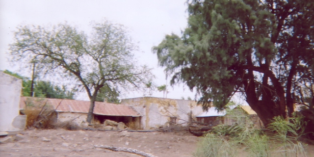
San Ygnacio, Texas, is the oldest town in Zapata County , it’s thirty miles south of Laredo using U.S Highway 83 and 14 miles northwest from Zapata.
Web Source: Texas Bob.Com
In 1828, Don Jose De Jesus Trevino bought land on the north of the Rio Grande River from the heirs of Don Jose Vasquez Borrego. In 1830, Don Jesus and two of his sons-in-law, looked for a place to set up a ranch house. They found a high flat area with the banks of the Rio Grande on the west and the Arroyo Grullo on the north. There they decided to build for their own protection. They would only be two sides that the Comanche and Lipan Apache Indians could attack, which was the south and the east, since the Rio Grande on the west and the Arroyo Grullo on the north. Don Jesus decide to names the ranch San Ygnacio after Revillas patrons saint, San Ignacio De Loyola.
In 1830, Trevino build a hand-cut sandstone building as his headquarters. Later 1851, Don Blas Maria Uribe started to expand the fort, during the expansion Jose Villarreal, a visitor to San Ygnacio asked Don Blas Maria if he can built a sundial and Don Blas Maria granted him permission. The fort was finally finished in 1871.
By 1878, there were about seven houses, some were Don Trinidad Uribe Home (1870), Don Proceso Martinez Home (2/3/1873), SR. Manuel Maria Uribe (5/105/1873)and Nuestra Senora Del Refugio Catholic Church (1872).
Before the Railroad Era in the late 19th century, San Ygnacio served as the center in trade between South Texas and Mexican markets. A ferry service, which was a canoe or a row boat, would cross the Rio Grande connecting San Ygnacio, Texas and San Ignacio, Mexico. Texas cattle was moving south into Mexico while corn, flour, beans and raw sugar was moving north into Texas.
Being a largely populated by farmers, laborers and following several years as a free border zone, San Ygnacio continued to thrive even when it was by passed by the railroad in 1880's.
Being the only legal crossing along the Rio Grande between Laredo and the lower valley for several years, the crossing was then closed in 1967 when the construction of a paved road on Mexican side linked Nuevo Guerrero to Nuevo Laredo, thus not needing to pass through San Ygnacio.
During the Civil War, Confederate troops fought followers of Juan N. Cortina to San Ygnacio. On June 15, 1916, troops of President Venustiano Carranza raided the United States border by firing at the U.S Calvary unit station there. Web Resource: Texas Escapes
In the early 1950‘s, San Ygnacio was scheduled to be purchased, abandoned and relocated with the construction of the Falcon Reservoir also known as Falcon Dam. In April of 1951, a committee headed by Mercurio Martinez, petition to have their land, and their town excluded from condemnation, on the grounds of the town site was above the anticipated water line and was safe from flooding of the reservoir. The petition turned out to be successful, the town's men, women and children were able to keep their land and town. Yet, two years later in 1953, San Ygnacio was hit with a flood, causing widespread damage.
Finally in 1972, San Ygnacio was placed on the National Register of Historical Places, and one of 11 most endangered historical places in the U.S. There is a total of 36 sandstone buildings, being the last South Texas town to have such a large collection of sandstone buildings from the nineteenth century.American Profile of San Ygnacio
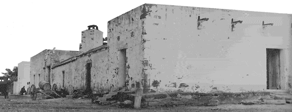
FORT TREVINO (“El Fuerte”)
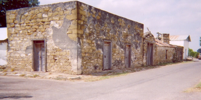
The Jesus Trevino Fort also known as “El Fuerte” is located on the corner of Uribe Avenue and Gutierrez Street.
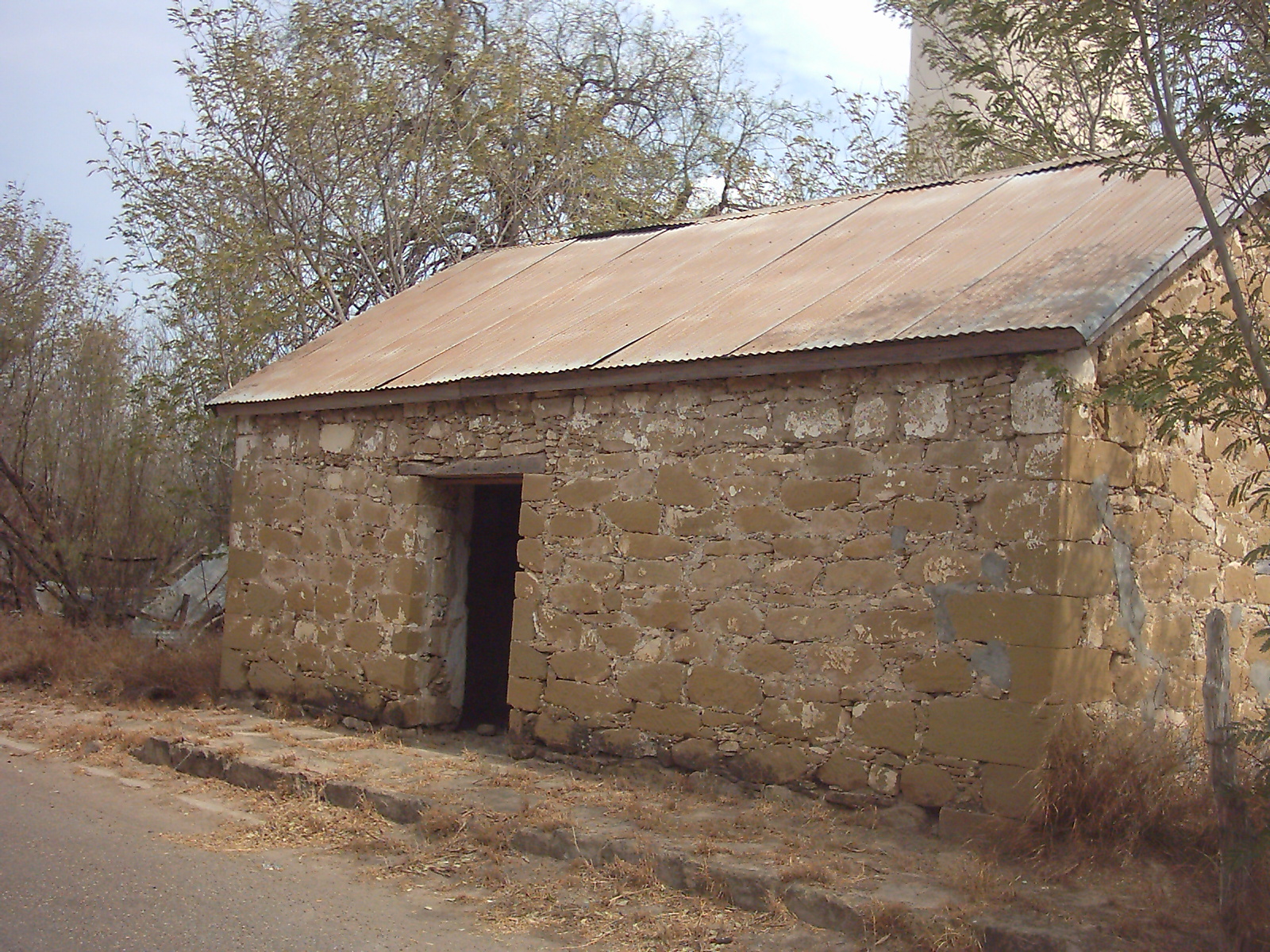
Fort Trevino was built in three sections, it was started in 1830 by Don Jose de Jesus Trevino. The fort was a one room building 18 feet by 20 feet, it was built to protect the Trevino family and the workers from the Indians raids and bandits.
Fort Trevino was built by true natural resources, the building is made by sandstone, some of which came from the banks of the Rio Grande River and from the hills in the area. The walls are about 18 thick and 12 feet high. The floor is dirt and the door is made of mesquite. The one door swings on two mesquite points resting on the sandstone. This part of the fort is known as “El Cuarto Viejo” (the old room) or “El Cuarto” (the room).
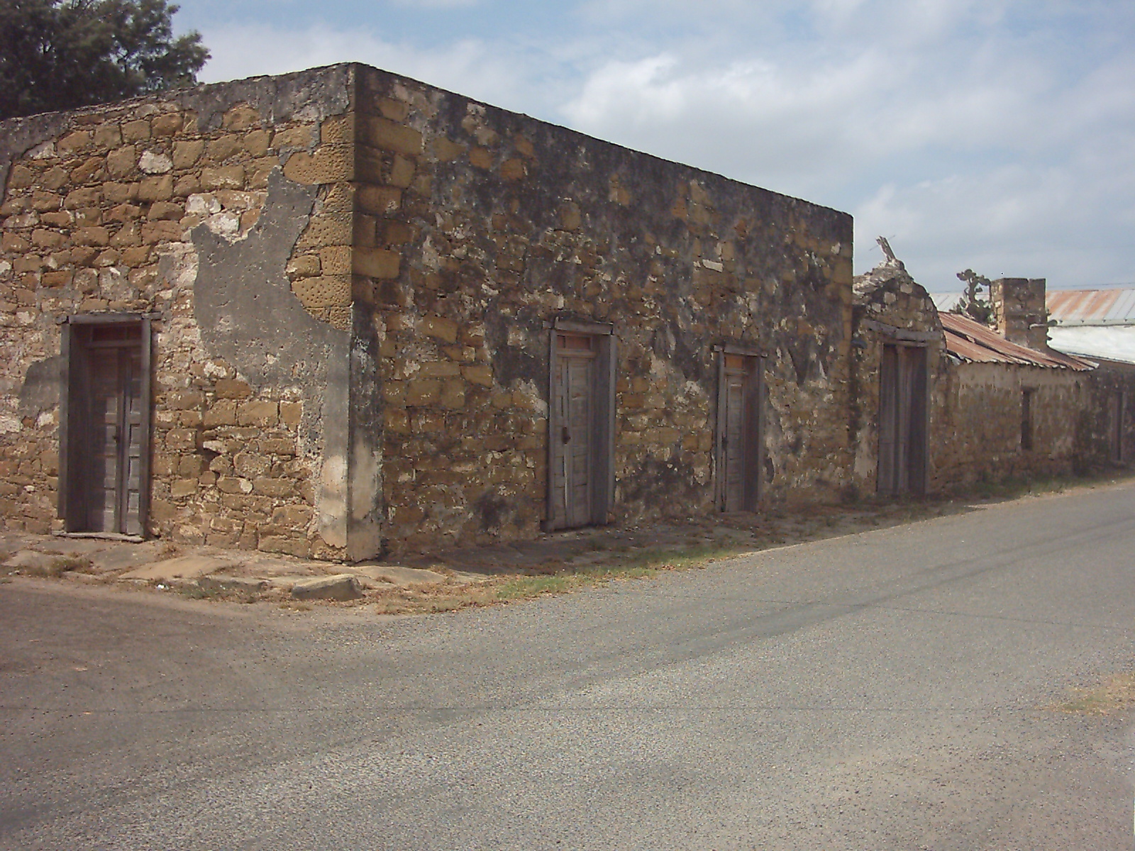
In 1850, Don Blas Maria Uribe, son-in-law of Don Jesus, moved to the fort seven years after Don Jesus passed away. Don Blas Maria and his son Fernando decided to build their new two-room home right next to Don Jesus’ room. They started the first room in 1951 and ended on October 2, 1851. During the building Don Blas Maria was asked by Jose Villarreal, a visitor to San Ygnacio, if can build a sundial on the fort and Don Blas Maria granted him permission. The second room was later finished on May 10, 1854, making the fort 100 feet by 120 feet. All the materials were basically the same, the way one can tell the difference between both sections is the roof “El Cuarto” has a flat roof and this section known as “La Casa Larga” (the Long House) does not.
Several years later, after burying his first wife, Dona Maria Julianna Trevino in 1856, Don Blas Maria married Dona Maria Tomasa Gutierrez Trevino and built her a new house just on the other side of Don Jesus’ room. This section of the fort was finished on December 10, 1871, and is known as “La Casa Pinta,” because of the garden and floral murals on the 10 foot walls inside.
In 1998, Fort Trevino was finally designated as a National Historical Landmark. Fort Trevino would held Christmas and Easter Procession and other major events. Now it is only open during the Christmas Homes Tour.See Texas Escapes for more.
“La Casa Larga” and “El Cuarto” is owned by the River Pierce Foundation of San Ygnacio, a non-profit organization dedicated to historical, cultural and environmental preservation. “La Casa Pinta” is owned by Mrs. Abigail Molina, Mrs. Raquel H. Ramirez and Mr. Alfonso Herrera, all descendants of Don Blas Maria Uribe.
SUNDIAL
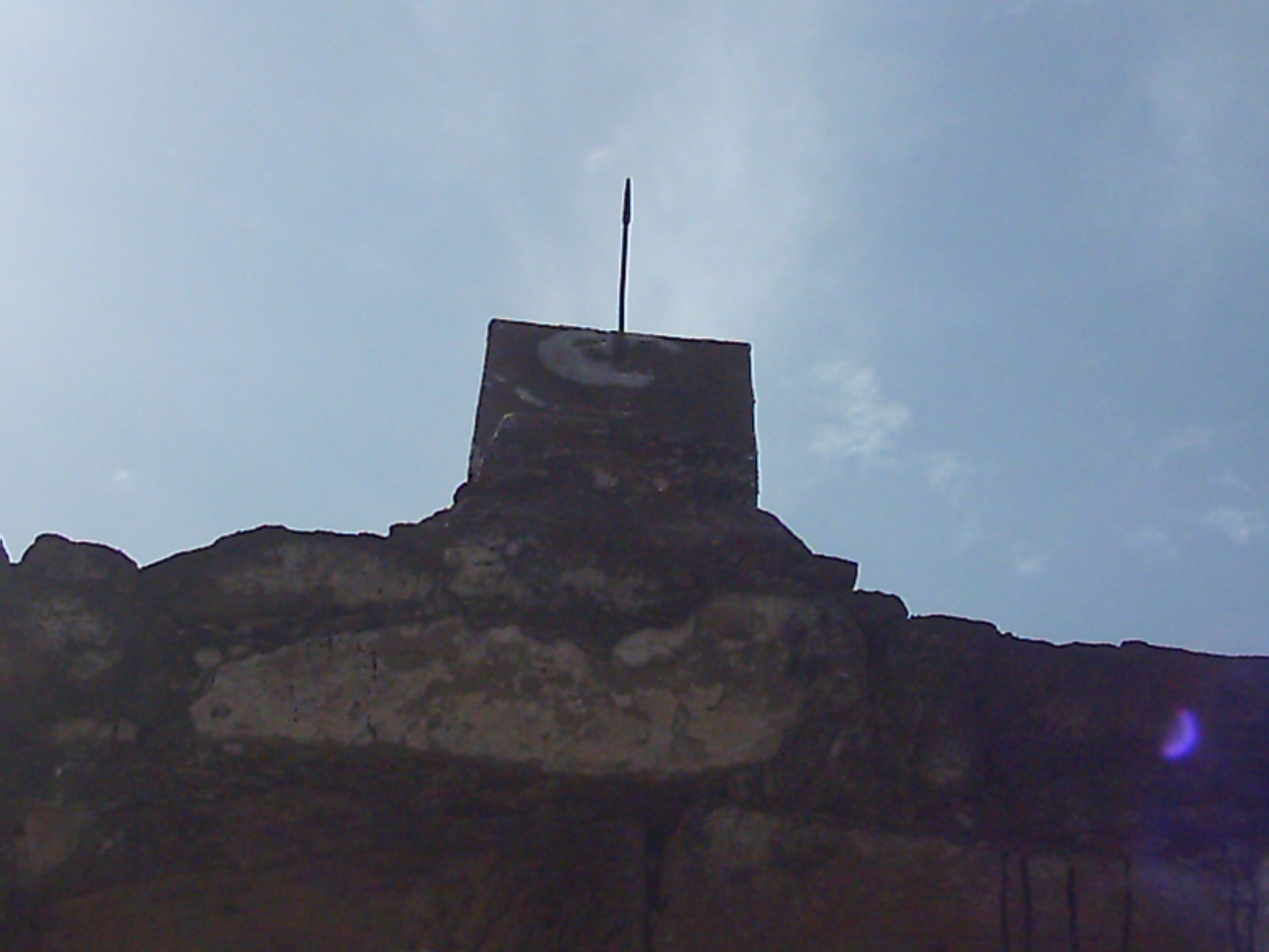
The story behind the sundial goes back to the 1820’s when Jose Villarreal and his cousin were captured by Indians. The boys were 13 years old and were captured from Revilla, Mexico. The Indians took the boys north for several days crossing the Rio Grande into Texas, where the boys managed to escape. Instead of heading south back to Mexico to avoid capture, the boys headed north, using the North Star as their guide. Villarreal and his cousin would only travel at night, during the day they would hide in the bushes and rest. Once the boys reached the Rio Grande they walked downstream to avoid leaving any footprints. They reached a village by the names of the Villa de Palafox, were the people nursed them back to health. Once healthy, they walked upstream until they reached Revilla.
Time went by, while Villarreal was visiting Mexico he saw a sundial and instantly wanted to learn how to build one.
In 1851, While visiting San Ygnacio Villarreal asked Don Blas Maria Uribe if he can build a sundial on the fort and Don Blas Maria granted him permission. Villarreal got two stones that looked identical, drilled a hole in the center of both and then placed a iron arrow in the center where the hole was drilled. The arrow is used the pointer. Now, the sundial is one of the most accurate in the world.
DON TRINIDAD URIBE HOUSE
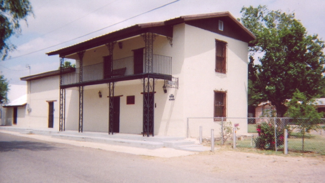
Don Trinidad Uribe House is located on Uribe Avenue and Agua Avenue.
The house was one of the few two-story rectangular sandstone houses built in 1870. It was built for Don Trinidad Uribe and Dona Francisca Garza Pena de Uribe, there they raised their 12 children. They passed the house down to their son, Serefin Uribe and daughter Maria Del Refugio Uribe. After Maria Del Refugio passing, Serefin married Emma Eva Yzaguirre from Falcon and had one daughter by the name of Maria Eva Uribe. Maria Eva lived there until 1963, when she married Jose Maria Ramirez, Jr. In 2003, Maria Eva restored the house to it’s original nineteenth century brilliance. The historic house mirrors traditional Mexican architecture with it’s two foot thick walls, high ceilings and wood beams, yet also incorporated modern day needs like a security system, air conditioning and heating.
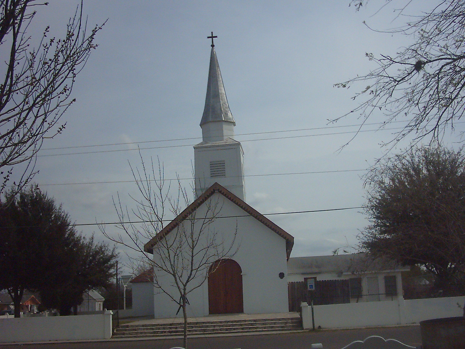
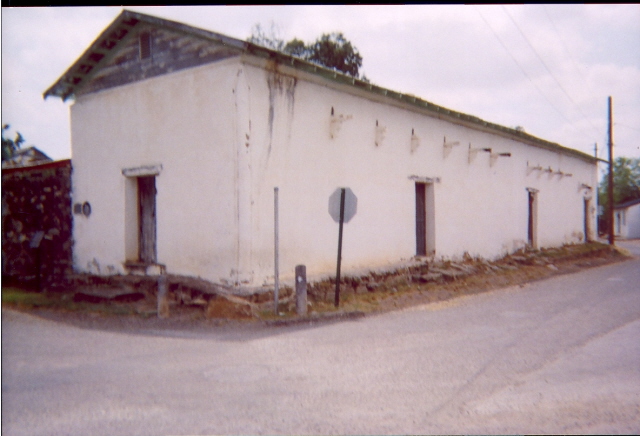
NUESTRA SENORA DEL REFUGIO CATOLICA CHURCH
Nuestra Senora del Refugio Catholic Church is located on Washington Avenue and Laredo Street.
Once Don Blas Maria completed “La Casa Pinta,” Dona Maria Tomasa asked her husband to build a church for the town. Don Blas Maria donated the land for a church and a plaza. In 1872, the church was completed, the Catholic Church was to be named “San Ygnacio de Loyola,” yet no statue of the saint was found. “Nuestra Senora del Refugio” was brought and so the name changed to “Nuestra Senora del Refugio Catholic Church. The church underwent modifications in 1884 and 1899, and in the 1960’s underwent contemporary alterations, covering up many of it’s pure architectural detail. From 1991 to 1993, Nuestra Senora Del Refugio went through a reconstruction due to a 1991 arson fire. The reconstruction was only on the damaged section of the church which was the altar, old and historical statutes, the vaulted ceiling, and the mesquite lintels over the windows. The reconstruction was all done voluntarily and was led by Dona Victoria Uribe. Efforts were funded by Meadows Foundation which matched the funds raised by local quilts, crafts, plates sales, and Jamaica’s. Now, Nuestra Senora Del Refugio Catholic Church is maintained by The Association of the Sacred Heart Society.
PLAZA BLAS MARIA URIBE (PLAZA DEL PUEBLO)
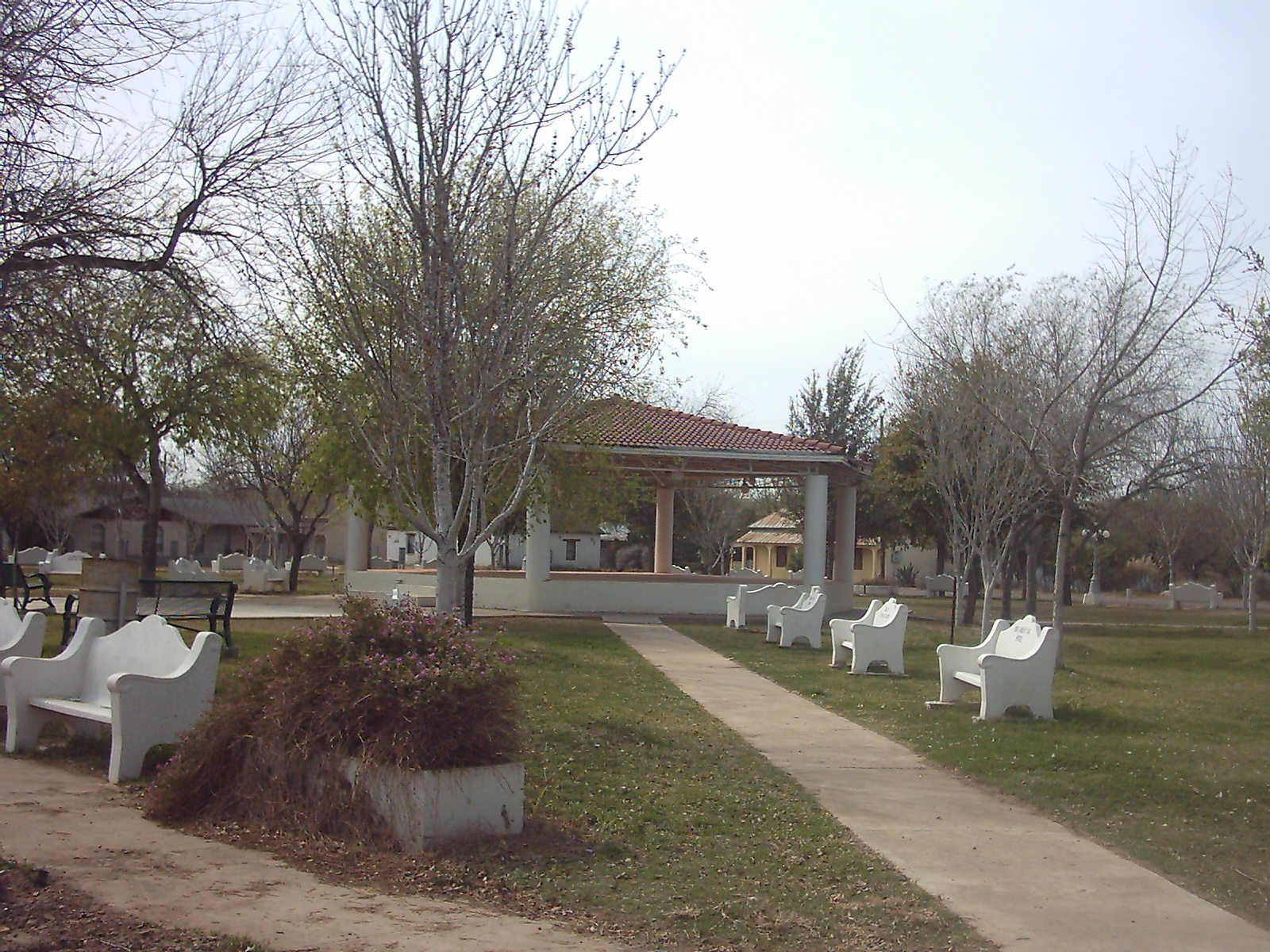
Plaza Blas Maria Uribe is located on Washington Avenue between Laredo Street and Gutierrez Street.
The land was donated by Don Blas Maria Uribe to build a park, yet the land remained undeveloped though the 1950’s. It was treeless, sandy and a place where children used to play baseball and other games. In the early 1950’s the movie “Via Zapata” was filmed in San Ygnacio and a gazebo was built in the center of the sand lot.
On June 13, 2005, the Zapata County Commissioners Court and presiding Zapata County Judge David Morales granted Dona Maria Eva Uribe Ramirez the request of legally naming the land from “Plaza Del Pueblo,” to “Plaza Blas Maria Uribe” in honor of her great-grandfather.
LA PAZ MUSEUM
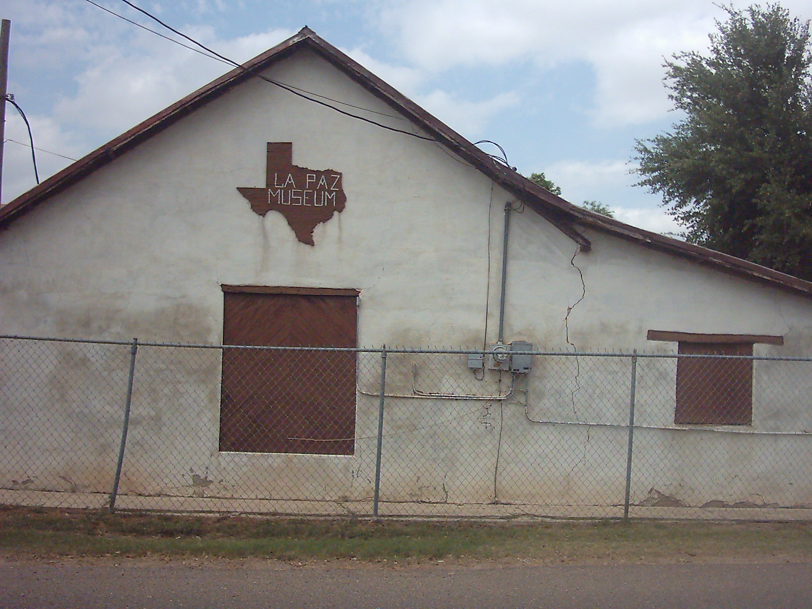
La Paz Museum is located on the grounds of Arturo L. Benavides Elementary (Lincoln Avenue and Hidalgo Street), the sandstone building was built in 1898 by Isidro and Margarita Gonzalez as their home. As time passed the building was used as the school of San Ygnacio, a cantina (bar), dance hall for the U.S troops sent there during the border troubles 1916-1918, as the school cafeteria, the band practice room, a storage area and now is La Paz Museum.
The museum was named after a frequently used phrase “En Paz & Libertad Obremos,” which mean “Let’s work for Peace and Liberty.” The ribbon cutting took place on Sunday, March 7, 1982. La Paz holds books, maps, newspapers articles, antique furnishings, artifacts and other related data to the area.
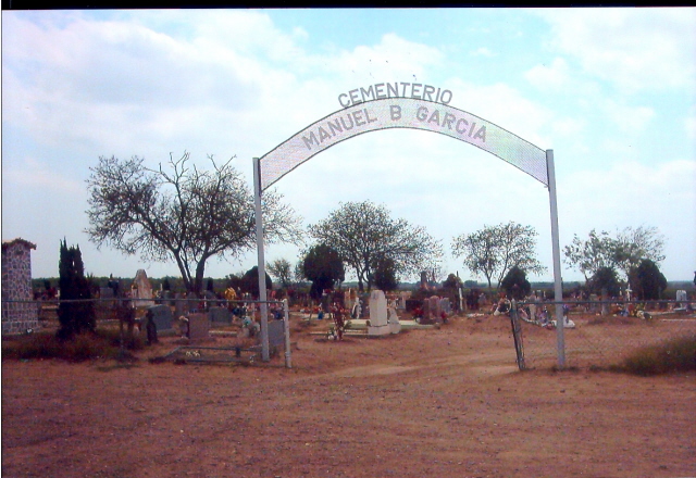
CEMETERIES
“Cemeterio Del Pueblo” was renamed to “Manuel B. Garcia Cemetery,” in honor of all he did in the community. “Cemeterio Uribe” was renamed to “Blas Maria Uribe Cemetery” just like the plaza, for all he did for the town of San Ygnacio.
In both of these Cemeteries you will be able to find tombstones dating back to the 1800’s. Also, tombstones that are made above ground. The uncommon tombs were built for those people of great status.
DESCRIPTIONS NOW
The historical homes in San Ygnacio are a up-close look at the first Spanish construction to the area. Many of the homes are build of 18 inch thick sandstone block, many which came from the Rio Grande River, feature their original mesquite doors and are architecturally about the same to the homes of Ciudad Guerrero. The narrow streets are names after many of the first settlers - Trevino, Benavides, Uribe, Gutierrez, Martinez, Garza, Vasquez Borrego - and for the American and Mexican presidents - Washington, Lincoln, Grant, Hidalgo, Morales, and Juarez.
RECENT EVENTS
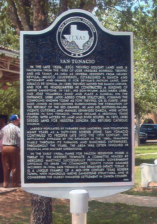
On April 1, 2006, San Ygnacio unveiled it’s Texas Historical Marker, it is located at Plaza Blas Maria Uribe. People who have ties to San Ygnacio attended. In attendance was Cynthia L. Villarreal, great-great-grand-daughter of Jose Villarreal, Dona Maria Eva Uribe De Ramirez, great-grand-daughter of Don Blas Maria Uribe, Mercurio Martinez Jr., son of Mericurio Martinez Sr. and Don Adrian Martinez, present owner of several historical houses. The whole event was history in the making.
YEARLY EVENTS
Every first Sunday in December, Cynthia L. Villarreal and other residents organize the A.L. Benavides Elementary Historical Home Tours & Birds and Butterfly Sanctuary in Historical San Ygnacio. This event offers vistors an up-close look at the early Spanish construction of the first settlers in the area. Among the old structures it varies by year.
In 2005, The Christmas Home Tours included Nuestra Senora Del Refugio Catholic Church, Don Trinidad Uribe Home, the Proceso Martinez Home, Don Manuel Maria Uribe Homes, the Jesus Trevino Fort and the Bird and Butterfly Sanctuary.
San Ygnacio,Texas
San Ignacio:A Tribute to Bob And Joe Uribe
More Photos
ANNOTATED BIBLIOGRAPHY:
The Handbook of Texas Online
This source provides a brief and minimum history on San Ygnacio.
Texas Escapes
This source has minimal information on San Ygnacio.
Texas Bob
This source helped me with information about nearby cities, but had minimal information about San Ygnacio.
San Ignacio: A Tribute to Bob And Joe Uribe
This source is terrific probably my best source, it not only has a detailed history on the town but about the land too. It provides you with family history too. I recommend this site for anyone who wants to know practically anything about San Ygnacio.
Villarreal, Cynthia L. Historical Home Tours & Bird and Butterfly Sanctuary San Ygnacio, Texas, December 4, 2005.
I loved this source. This manuscript proves information on mostly all the sites in San Ygnacio, something I did not find in other sources. I would like to thank Ms. Villarreal for the welcome and information she provided me with.
American Profile
This source has a brief history on San Ygnacio.
More Histories of Small Towns in South Texas