| Michael R. Causey | Fall 1998 |
| History 1301 | Hines |
Click on map to see larger view.
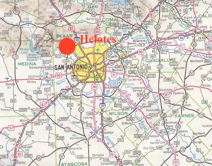
The present day city of Helotes lies approximately 12 miles (direct line) Northwest of downtown San Antonio. The South-East boundary of this small, irregularly shaped municipality is now one fourth of a mile from the North-West boundary of its large, aggressive neighbor. Helotes incorporated in 1981. A 1995 almanac survey based on estimates by local officials lists the population at 1,979, and the businesses at 205.
It is currently experiencing a growth spurt accompanied by pressure from large developers to downsize the size of lots required for new homes. City Council is evenly split regarding requests to downsize lot sizes. Sandra Day O'Connor High School has been built there by the North Side Independent School District, in spite of doubts about the need for that facility.
ORIGINS: "FOUNDING FATHERS":
According to The New Texas Handbook, 1996, Helotes was settled by Mexicans around 1856. These settlers intermarried with Apaches in the area, and included a man named Chaca, who is said to be the first to build a house, the first to cultivate corn there,
and the possible origin for the name Helotes, which translates to "green roasting ear of corn".
HISTORICALLY SIGNIFICANT STORIES?:
After the Texas revolution, the Republic Of Texas was in desperate
need of funding. The young nation took its greatest wealth, land, and put it on the market in the form of scrip. Scrip were notes for a given number of acres of land in The Republic Of Texas. Using scrip, the owner could survey and claim any land in Texas not already "owned". Scrip was sold inside and outside of Texas, usually by a company dealing in real estate, such as the Toby Company.
ECONOMY:
The future of Helotes is the future of any sparsely occupied, pristine land next to an expanding population center. People will come in ever-increasing numbers, just as they always have. Some of the present population will resist with will and skill, just like the Indians. Some will see advantages in new alliances and accept newcomers, just like the Indians.
FUTURE PROSPECTS:
The ecology of Helotes does not have such a bright future. The Edwards and Glen Rose aquifer have already been impacted by development. Wells have dropped or run dry where golf courses have started extensive pumping- Test wells that were previously pristine have started showing "hits" when tested for industrial pollutants. The water is still within standards for potable water, but its not what it used to be. More intensive use of the land will not improve this situation.
Photo Gallery
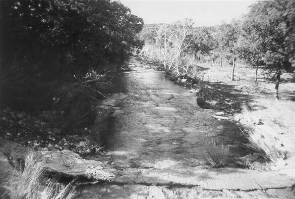 |
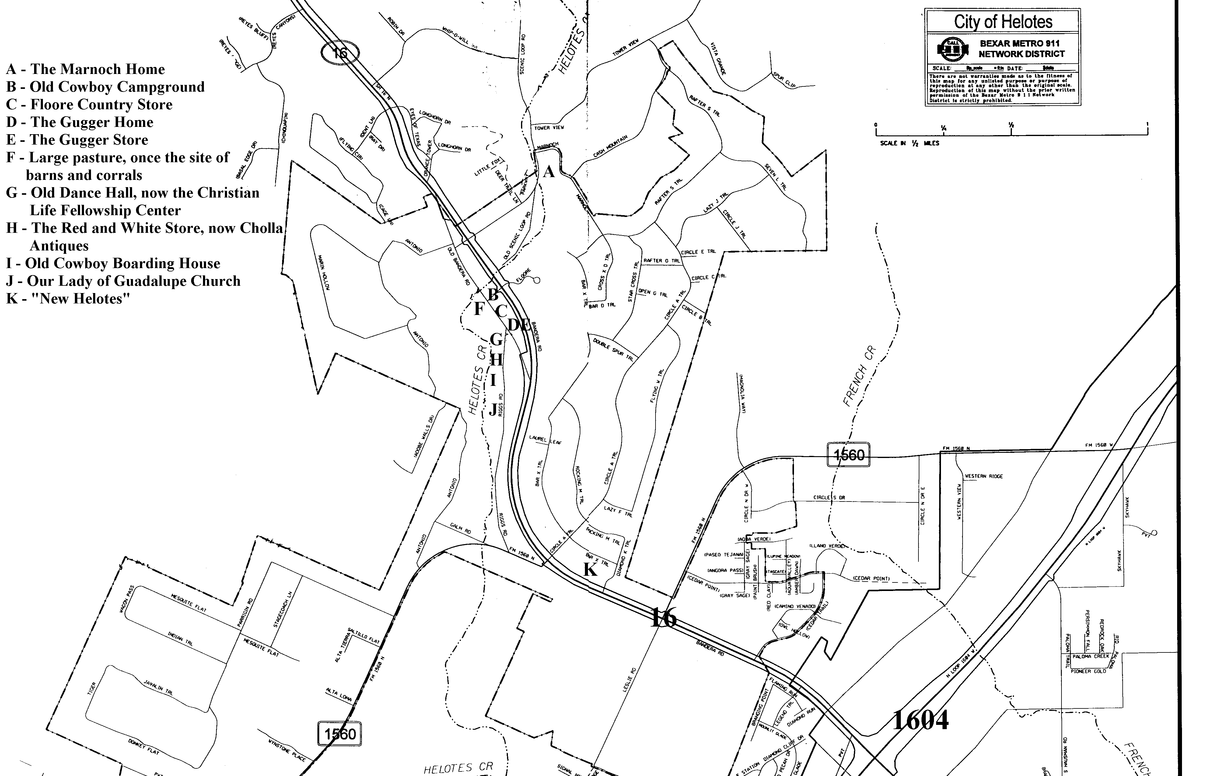
Helotes Creek Photo is taken from the bridge on 'Old Helotes Highway', about 200 yards from the Gugger place. Cattle and cowboys would have over-nighted within a few yards of here. |
| Historical Marker Historical Marker placed in front of the Gugger Home, in Old Helotes. |
 |
 |
Elizabeth Ann Menchaca, and her husband, Hawk This picture was taken behind their residence on Menchaca Road. The house next to theirs is still in the Menchaca Family and a brick in it's wall dates the house as being built in the 1850's. Elizabeth's house is about 200 yards from a cave where the Menchacas are said to have lived. |
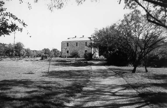
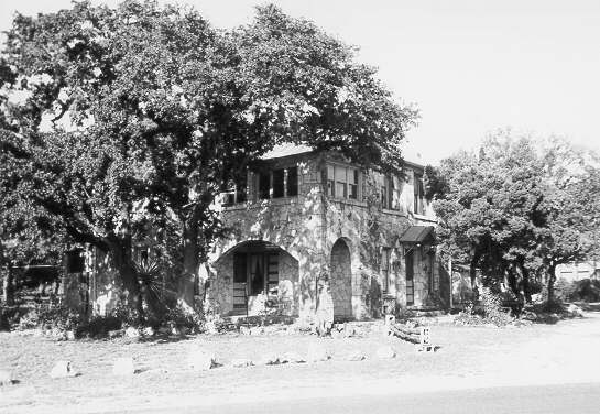
| The Marnoch Home The front of the Marnoch Home (now owned by Mr. Kennedy, a Grey Forest Resident). The door opens to face the west. The house seems to be a 2-story, but according to Mr. Kennedy is a 3-story. |
 |
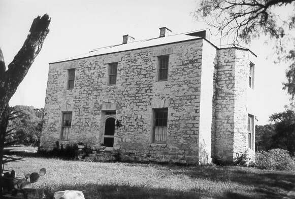 |
The Marnoch Home Front Close-up A close-up view of front of the Marnoch Home. The stonework over the first floor windows is said to resemble architectural designs in San Antonio that are attributed to Francis Giraud. |
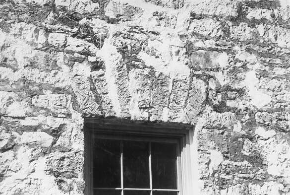
| The Marnoch Home Stonework A close-up view of the stonework over one of the back (East) windows, that resembles the work of Francis Giraud. |
 |
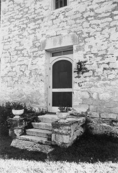 |
The Marnoch Home Front door A close-up view of the front door and steps at the Marnoch Home. |
| The Marnoch Home, back view The southside and back view of the Marnoch Home. The back door opens to the east. |
 |
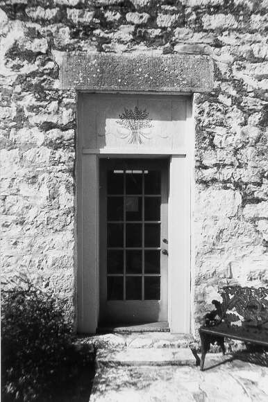 |
Back Door of the Marnoch Home The back door of the Marnoch Home opens to the morning sun. The Marnoch Home is on Marnoch Road in Grey Forest, once a part of Helotes. |
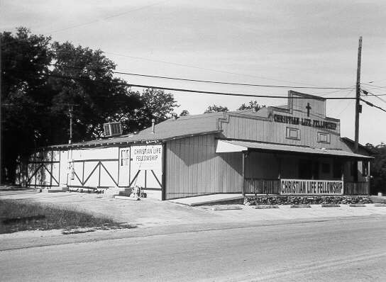
| Christian Life Fellowship The Christian Life Fellowship occupies a building from around the turn of the 20th century. It was originally a Dance Hall. |
 |
 |
The Old Cowboy Boarding House The Old Cowboy Boarding House on the east side of Riggs Road in Old Helotes was often used by cowboys going from Bandera to San Antonio. This building is wood with stone veneer. In it's original form it had a continuous porch, or at least a porch on each side. It was built on the back of it's lot and later moved to the front of the lot. |
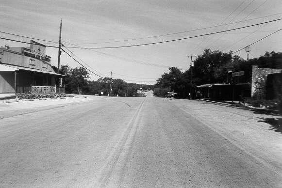
| Old Helotes This is a picture of Old Helotes. The old Dance Hall is seen on the left (west) side of Old Bandera Road (center). The building on the right (east) side of Old Bandera Road is the Gugger Store, now the Hickory Hut BBQ. The Gugger Home is on the right beyond the store, but is not visible in this shot. The camera is pointing north. The photo was taken from the intersection of Old Bandera Road and Riggs Road. The road in this photo drops down to the bridge over Helotes Creek, about 250-300 yards from Bandera and Riggs. 100 years ago you could have stood here and seen cowboys and Indians riding horses. Now you can stand here and see cowboys and Indians riding pick-up trucks. |
 |
 |
The Gugger Home The front view of the Gugger Home on Old Bandera Road, in Old Helotes. It is the current home of Hank and Kyle Cunningham. The lower portion of the house contains Helotes Bicycle. The Gugger place was built in 1881, one year after the land was "conveyed" to Arnold Gugger. Local talk has it that the younger Dr. Marnoch (George) shot one of the Guggers, and the land was given as compensation. (Notice the Historical Marker to the right of the picture) |
| The Gugger Home A closer view of the Gugger Home. |
 |
 |
Formerly the Gugger Store The Hickory Hut Bar-B-Q was formerly the Gugger Store. The Gugger Store in Old Helotes on Old Bandera Road was altered when the road was widened and paved. The original front of the building was cut off. The Gugger Home is to the left in this photo. |
| Cowboy's Pasture This pasture is on the west side of Old Bandera Road, across the street from the Gugger Place. Local talk has it that this spot once contained barns and corrals used by cowboys moving livestock from Bandera to San Antonio. The pasture is a few yards south of Helotes Creek. |
 |
 |
Old Cowboy Campground The hardware store in this photo is the suspected site of a "cowboy campground" used by cowboys moving livestock to San Antonio. The site would have had no buildings at that earlier time. The site is on the east side of Old Bandera and to the south of Helotes Creek. The bridge over Helotes Creek is seen on the left side of the photo. The suspected site of the corrals used during these "short" drives is on the left side of Old Bandera Road, pictured here. The Gugger Place is about 50 yards to the right, but is not visible in this photo. |
| Cholla Antiques Hank Cunningham mentions that this present day antique shop is located in what was called a "Red and White Store" during WWII. This building is located on the west side of Old Bandera Highway, between the old Dance Hall and the old Cowboy Boarding House. |
 |
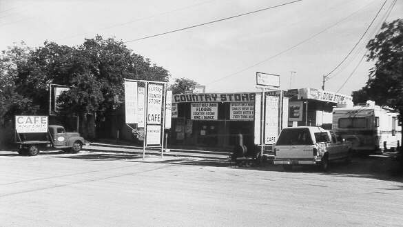 |
Floore Country Store Floore Country Store on the east side of the Old Bandera, next to the Gugger Place, is well as one of the places where Country and Western singer Willie Nelson frequented/played early in his career. He still comes there to play from time to time. The store was built in 1942. The cluttered appearance is in keeping with the "honky-tonk" atmosphere generated during live entertainment. |
| Our Lady of Guadalupe Catholic Church The original building (foreground) of Our Lady of Guadalupe Catholic Church was built in 1957-58. The main building (background) was added later. The older building was built by parishioners, not contractors. When the church made plans to destroy the older building for expansion, Hank Cunningham and another resident served the church with a restraining order, thus preserving the original church building. |
 |
BIBLIOGRAPHY: Cunningham, Kyle. Personal interview. 7 November, 1998. Dallas Morning News. 1998-1999 Texas Almanac And State Industrial Guide, Dallas: Dallas Morning News, 1998. Freeman, Martha Doty. A History of Government Canyon State Property, Bexar County, Texas. For Texas Parks And WildLife Department, Austin, Texas. 1994. Gillis, Jo Ann Kesler. Helotes Happenings, Austin: Nortex, 1998. Texas State Historical Association. The Handbook of Texas. 2 Vols. Austin: Texas State Historical Association, 1952. Texas State Historical Association. The Handbook Of Texas. 6 Vols. Austin: Texas State Historical Association, 1996. The Floore Country Store, another WWII addition to Old Helotes. It is well known to Willie Nelson fans in the area. The cluttered appearance is in keeping with the "honky-tonk" atmosphere generated during live entertainment. WEBSITES: Handbook of Texas Online: HELOTES, TX Hindu Temple of San Antonio